Magoffin County Maps
Historic Maps
1818 - A crop of the
Magoffin area from Dr. Luke Munsel's 1818
map of Kentucky. This is one of the first maps showing Licking Station
and Burning Spring, both on the Licking River, as well as the Old State
Road running between Mt. Sterling and prestonburg. Courtesy of Kentucky
Historical Society
1880 - a crop of
the Magoffin area from Kentucky Geological Survey's
map of Morgan, Johnson and parts of Magoffin, Floyd and Martin
counties. A great map for family researchers showing numerous
landowners, creeks and early roads. Courtesy of Library of Congress.
1948 - a crop of Magoffin from a Hammond Railroad map of Kentucky. Courtesy David Rumsey Map Collection.
1950 - a Highway and Transportation map of a more advanced Magoffin County showing communities, creeks and additional roads. Courtesy of Kentucky Transportation Cabinet
Formation Maps
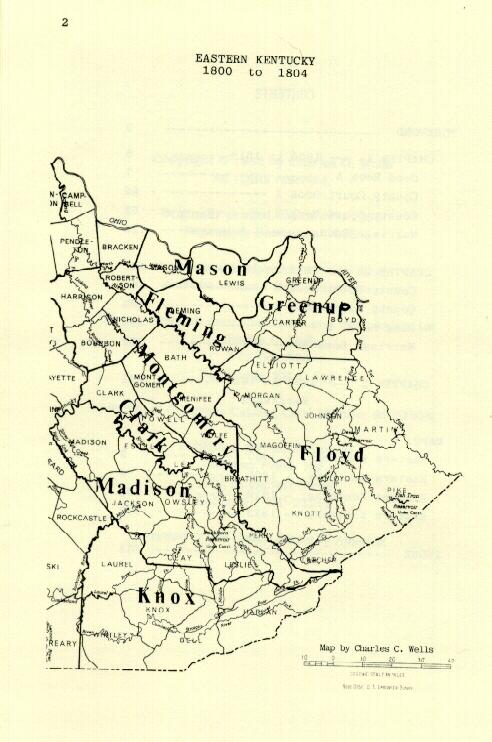
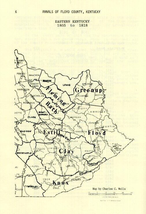
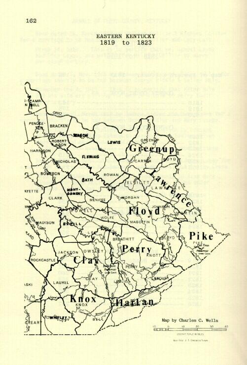
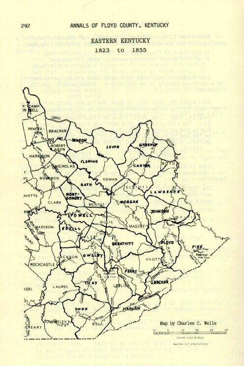
Use of the following maps of Eastern Kentucky Counties has been graciously
permitted by Charles C. Wells from "Annals of Floyd County, Kentucky
1800-1826"
Eastern KY 1800
Eastern KY 1805
Eastern KY 1819
Eastern KY 1823